
Abstracts for Florida 2021 Summer SAR Workshop
SAR data processing Giacomo Falorni The processing of SAR satellite imagery is known as InSAR, which is a remote sensing technique used to measure ground movement. Measurement point clouds can …

SAR data processing Giacomo Falorni The processing of SAR satellite imagery is known as InSAR, which is a remote sensing technique used to measure ground movement. Measurement point clouds can …

The Proceedings of the ASPRS 2020 Annual Conference have now been published in the ISPRS Archives. These papers are available at the following link: https://www.int-arch-photogramm-remote-sens-spatial-inf-sci.net/XLIV-M-2-2020/
Need a position filled? ASPRS.org is seen by thousands of industry professionals every single day! Post your job opening on this site, as well as in the ASPRS weekly newsletter …
Request ASPRSorg membership
If you would like to submit your presentation to the proceedings, please contact programs@asprs.org Not all presentations have been shared by authors.
The Florida Region of ASPRS has a long standing tradition of helping support students with travel subsidies in order to attend the National ASPRS conference. This year, with the help …
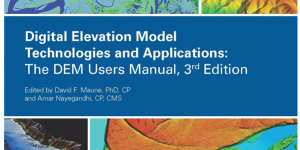
The 3rd edition of the DEM Users Manual includes 15 chapters and three appendices. References in the eBook version are hyperlinked. Click here to pre-order
The ASPRS 2018 Annual Conference will be co-located in Denver, Colorado with the 18th Annual International LiDAR Mapping Forum (ILMF). We are seeking presentation abstracts based on ASPRS core disciplines …
The Florida Region of ASPRS held it’s popular LiDAR Workshop on Nov 16th 2018 at the UF/IFAS Mid-Florida Research and Education Center in Apopka, FL. Gold Sponsors Silver …
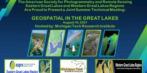
A joint meeting of the 21st William T. Pecora Memorial Remote Sensing Symposium and the 38th Int’l Symposium on Remote Sensing of Environment (ISRSE-38)

Eight vignettes prepared by the ASPRS Films Committee are now available for viewing here (or you can view them on the ASPRS YouTube channel). These short films cover the following topics: LiDAR; Aerotriangulation; Aerial Survey Pioneers; Geospatial Intelligence during WWII; the Role of Women; Photogrammetry in Space Exploration; the Evolution of Analog to Digital Mapping; and ASPRS Membership (the newest film).
There is no excerpt because this is a protected post.

www.forestsat2018.forestsat.com Come join us 2-5 October 2018 in College Park, Maryland, USA for the pre-eminent conference on the application of spatial analysis and remote sensing technologies for forest monitoring and …