Posts

ASPRS Executive Director James Plasker Announces His Retirement

 ASPRS Executive Director James Plasker has announced his retirement from ASPRS and plans to step down from his position effective January 2014. Plasker was selected as the Executive Director in 1998 to succeed William French who had served in the position for 20 years.  
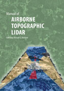
As ASPRS Executive Director for nearly 16 years Plasker led or significantly contributed to numerous programmatic efforts on behalf of the ASPRS membership and the broader geospatial community.  These included resolution of professional licensure issues and expanded geospatial representation to the National Council of Examiners for Engineering and Surveying (NCEES); development of the Ten Year Remote Sensing Industry Forecast (Phases I-IV); increased awareness of Landsat data continuity issues and the requirement for a National Land Imaging Program; ASPRS participation in several U.S. Department of Labor career and statistical reporting programs including NAICS and ONET; expansion of both thenumber and monetary value of the ASPRS awards and scholarships endowed through the ASPRS Foundation; supported a number of ASPRS studies on camera calibration digital orthophotography and the value of Landsat data; aided ASPRS volunteers in the development of the LAS common data exchange standard and the best practices guidelines for procurement of professional geospatial services and geospatial products; oversaw expansion of the ASPRS Certification Program to include technologists and intern categories; and increased efforts to support the accreditation of applied science and engineering programs through his continuing service to the Accreditation Board for Engineering and Technology (ABET).

ASPRS Lidar Division Releases First LAS Domain Profile

Thanks to a recent initiative of the ASPRS Lidar Division different segments of the lidar mapping community now have the ability to customize the LAS file format to meet their application-specific needs.  The new mechanism that makes this possible is the LAS Domain Profile which is a derivative of the base LAS v1.4 specification that adds (but does not remove or alter existing) point classes and attributes.

San Diego 2010

  2010 San Diego Conference Proceedings Archive [NOTE: Please be sure your browser supports opening PDF formated documents directly within the browser.]  

ASPRS Launches First eBook – Manual of Airborne Topographic Lidar

The American Society for Photogrammetry and Remote Sensing (ASPRS) is pleased to announce the launch of its first eBook — Manual of Airborne Topographic Lidar — on the Kindle platform.  “Making the Manual available as an eBook gives customers the option to have it available at their fingertips on either a Kindle or on another device with a Kindle app,” said ASPRS Communications Director Kim Tilley.  “This is perfect for students and those working in the field who don’t want to carry around the printed book or for those needing quick delivery with no mailing costs.”  The eBook is available through Amazon at http://www.amazon.com/dp/B00E3FWBO6.

MANUAL OF PHOTOGRAMMETRY SIXTH EDITION NOW AVAILABLE

The American Society for Photogrammetry and Remote Sensing (ASPRS) announces the Manual of Photogrammetry Sixth Edition is now available for purchase through the ASPRS Bookstore.

Under the leadership of J. Chris McGlone PhD CP as Editor-in-Chief and George Y.G. Lee PhD Technical Editor the Manual covers photogrammetry in depth as well as its constituent technologies providing the student practitioner or researcher with a single valuable reference resource.

ASPRS INITIATES DEVELOPMENT OF MANUAL OF REMOTE SENSING 4TH EDITION

The American Society for Photogrammetry and Remote Sensing (ASPRS) has initiated development of the fourth edition of the Manual of Remote Sensing (MRS) under the leadership of Stan Morain as Editor-in-Chief Mike Renslow as Associate and Technical Editor and Amelia Budge as Associate and Design Editor. This project planned for completion in 2015 will be designed and executed as an enhanced e-book and will focus on three Parts: Systems Data Management and Applications.

The Joint Agency Commercial Imagery Evaluation (JACIE) Team Announces its 2014 Workshop to be Held in Conjunction with the ASPRS 2014 Annual Conference

The Joint Agency Commercial Imagery Evaluation (JACIE) team will hold the 2014 JACIE Workshop in conjunction with the American Society for Photogrammetry and Remote Sensing (ASPRS) Annual Conference in Louisville Kentucky on March 23-27 2014.  The announcement was made by the JACIE team and keynote speaker Roberta Lenczowski (ASPRS Past President) during the Workshop in Saint Louis Missouri in April.

The 2014 JACIE Workshop will be held Wednesday through Friday beginning on March 26 as a separate track at the ASPRS meeting. The program planning for JACIE and ASPRS will integrate some key speakers and highlights into a few ASPRS special and/or hot topics sessions. In addition ASPRS will provide attendees to the JACIE Workshop with the opportunity to register for a combined JACIE/ASPRS experience that will allow JACIE attendees to visit the ASPRS Conference Exhibit Hall as well as ASPRS General and Technical Sessions as time permits during the week of the JACIE Workshop.